Introduction
Tutorials
Getting familiar with GeoData Manager
Changing how GeoData Manager looks
Scenarios for using GeoData Manager
Data types and nodes
Help with data types and nodes
Getting familiar with GeoData Manager
Changing how GeoData Manager looks
Scenarios for using GeoData Manager
Help with data types and nodes

GeoData Manager's simulation functions are to prepare data for, and to display data from, external simulation applications. In this section:
You refers to a GeoData Manager user,
The modeller refers to the person running the external simulation applications (TOUGH2 or TETRAD) and the front-end applications (Mulgraph or Geocad for TOUGH2).
You and the modeller exchange files of data as the simulation develops. In GeoData Manager, export or import the data, for example as csv files. Export and import can be set up to export or import files of different formats, but if you still can not match the modeller's file formats then use a format you can open in a spreadsheet, like csv, and write spreadsheet macros to make the files compatible.
The simulation tools in GeoData Manager are simpler than the tools available to the modeller, but they are tools that you can use easily. And there are conveniences, for example that GeoData Manager can convert depth down a well to location in space or to grid layer and block.
This help guide is not a primer for how to do simulations.
For the TOUGH2 simulation application.
Lists the TOUGH2 simulation grids you have entered, for both Mulgraph and Geocad:
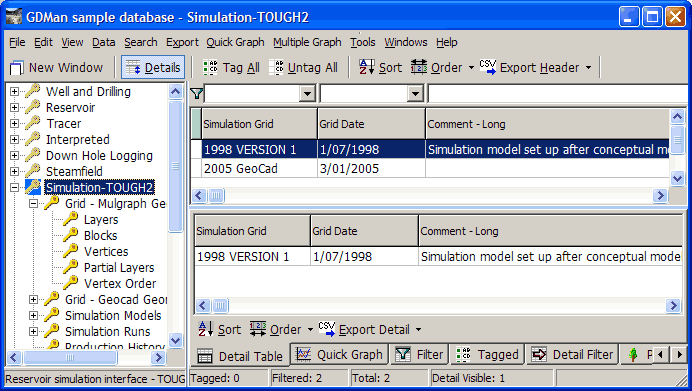
Lists your TOUGH2 simulation grids for Mulgraph:
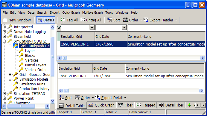
The modeller creates the grids and their properties; you import them into GeoData Manager. Do not change them.
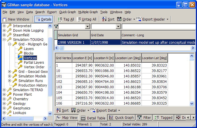
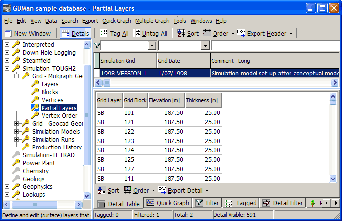
A Mulgraph grid has blocks of any shape or size (providing each cell has straight vertices and is is convex). Each grid layer of the grid is horizontal and of uniform thickness. The block pattern is the same in every layer. There can be any number of partial layers at the top, each with uniform thickness.
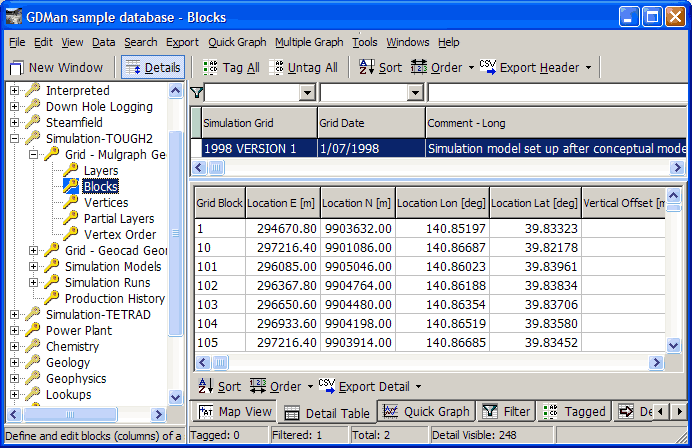
The sub-nodes define the properties of the grids, for example for grid 1998 Version 1:
Layers
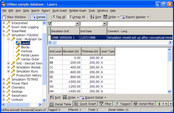
Elevation is the elevation of the top of the layer.
Layer Type: A: all blocks are in the layer; P: a partial layer, with only some blocks in the layer.
Blocks
Vertices
Partial layers
Vertex order
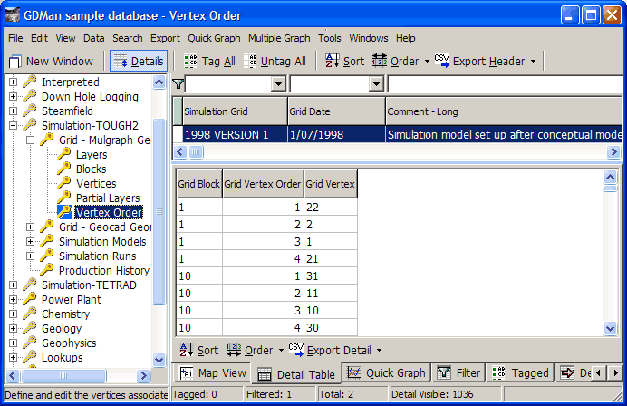
To create a new grid, go to Grid - Mulgraph Geometry and use New to enter header data. Then go to each sub-node in turn and use Edit to enter detail data.
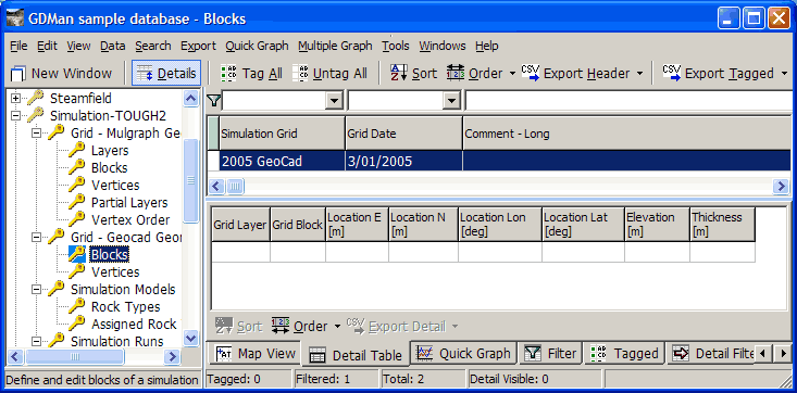
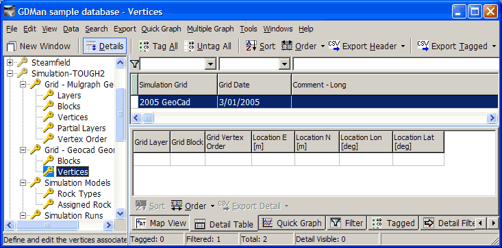
Lists your TOUGH2 simulation grids for Geocad:
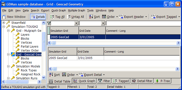
The modeller creates the grids and their properties; you import them into GeoData Manager. Do not change them.
The sub-nodes define the properties of the grids, for example for grid 2005 Geocad:
Blocks
Vertices
Lists your simulation models for each simulation grid:
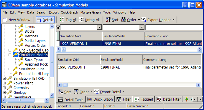
The modeller creates the models and their properties; you import them into GeoData Manager. Do not change them. A model is for a grid, for example model 1998 Final for grid 1998 Version 1.
The sub-nodes define the models, for example for model 1998 Final:
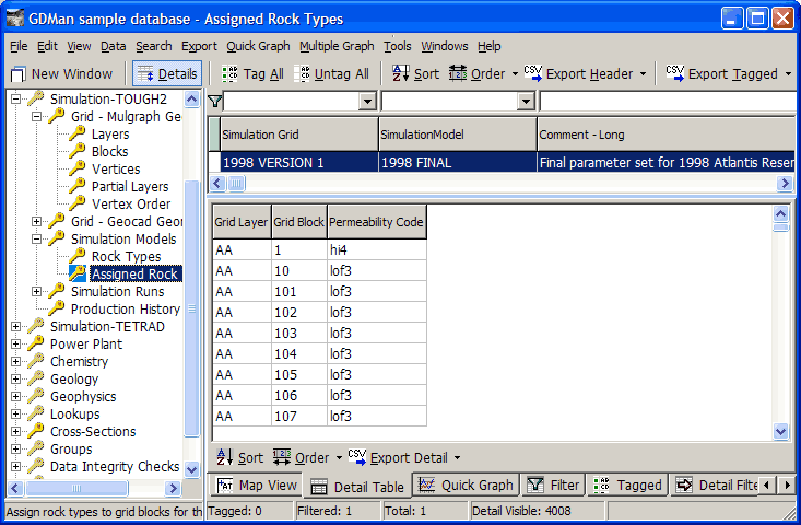
Rock Types Defines rock types (Permiability Codes) and their properties:
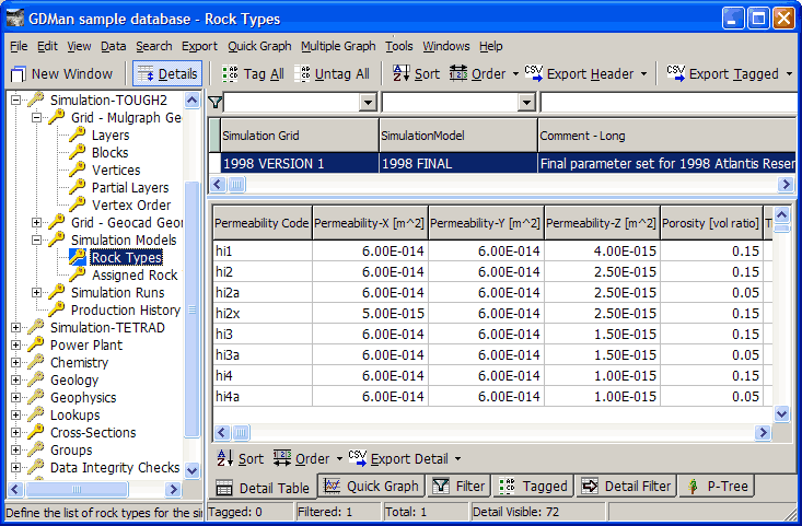
The modeller usually makes up codes based on the names of the rock estimated to be under the field (eg hi) and then adds suffixes to account for variations in the properties of that rock through the field (eg hi1, hi1, hi2a, hi2x):
Assigned Rock Types Assign a rock type (Permiability Codes) to every block in every layer:
Lists your simulation runs for each simulation model:
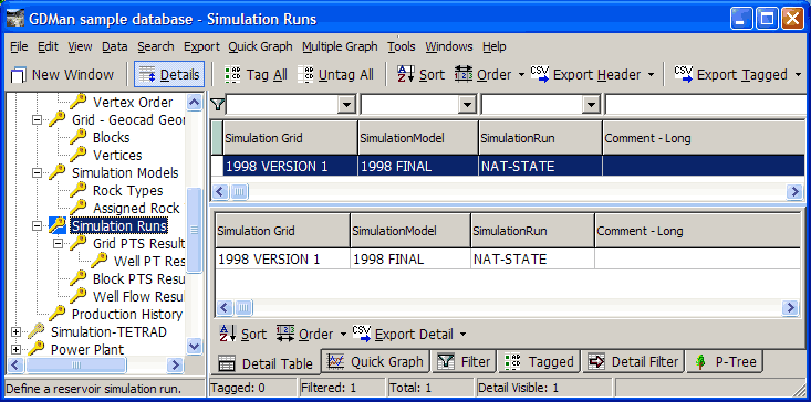
The modeller creates the runs and their results; you import them into GeoData Manager. Do not change them. A run is for a model, for example run NAT-STATE for model 1998 Final.
The sub-nodes have the results of the run, for example for run NAT-STATE:
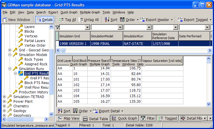
Grid PTS Results Calculated pressure, temperature and saturation for every block at a given time:
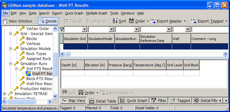
Well PT Results Calculated pressure, temperature down a given well at a given time:
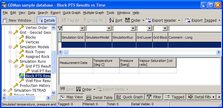
Block PTS Results vs Time Calculated pressure, temperature and saturation for one block over time:
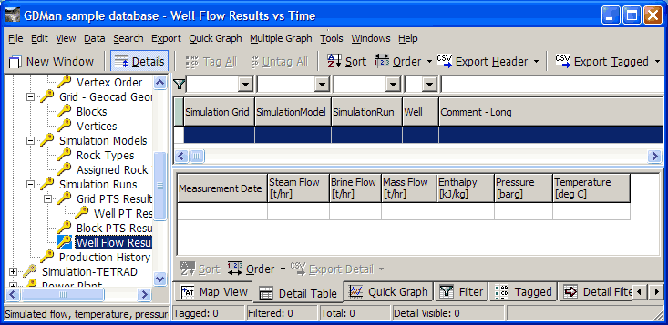
Well Flow Results vs Time Calculated mass flows and wellhead enthalpy, pressure and temperature for a given well over time:
For the TETRAD simulation application. For the TETRAD simulation grid, each grid block must be rectangular, with each row and column having a constant width. The thickness and elevation of each block can be individually assigned.