Introduction
Tutorials
Getting familiar with GeoData Manager
Changing how GeoData Manager looks
Scenarios for using GeoData Manager
Data types and nodes
Help with data types and nodes
Getting familiar with GeoData Manager
Changing how GeoData Manager looks
Scenarios for using GeoData Manager
Help with data types and nodes
The Interpreted module is used to store a variety of interpreted data relating to the geothermal system.
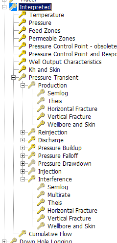
Choose the correct data type category to use, depending on the kind of data you want to enter or work with:
| For this kind of data | Choose this category |
|---|---|
| Temperature | Temperature |
| Pressure | Pressure |
| Feed zones | Feed zones |
| Permeable zones | Permeable zones |
| Pressure control point & response | Pressure control point & response |
| Well output characteristics | Well output characteristics |
| kh & Skin | kh & Skim |
| Pressure transients | Pressure transients |
| Cumulative flow | Cumulative flow |
Except for Pressure Transient data, every test/data set in the Interpreted module is defined by four identifiers, which make up the name of the test:
| Identifier | Comment |
|---|---|
| Well | The name of the well |
| Well Interpretation Type | A code to determine the type of data set |
| Reference Date | The date for which the interpretation is valid. |
| Reference ID | An identifier which can indicate data source, interpretation method or even the interpreter. |
At the Interpreted node, it is possible to view all tests that use widiary header table: TEMP, PRES, FEED, PERM, WOC and CFLO.
Interpreted temperature data represents a "best estimate" of the formation or reservoir temperature. The data used to make this estimate is usually obtained from downhole temperature surveys, but can be derived from other sources such as static formation temperature - SFTT tests during drilling, alteration information, etc.
The Reference Date should relate to the date when the defining measurements were made, not the date when the interpretation was made.
For any well, there can be any number of interpreted temperature profiles, perhaps corresponding to different data sources, different times during the exploitation of the resource or even estimates by different interpreters. The Reference ID should be used to clearly differentiate between these different interpretations.
This field specifies the primary Vertical Length field for interpreted temperature or pressure profiles; select either depth (measured depth) or elevation.
If Depth / Elevation = Depth
intpt table) is automatically calculated from the Depth.If Depth / Elevation = Elevation
If you wish to change the primary Vertical Length field:
Interpreted pressure data represents a "best estimate" of the formation or reservoir pressure. The data used to make this estimate is usually obtained from downhole pressure surveys, but can be derived from other sources such as pressure falloff - PFO or pressure buildup - PBU tests, etc.
The Reference Date should relate to the date when the defining measurements were made, not the date when the interpretation was made. Select depth or elevation as for interpreted temperature.
For any well, there can be any number of interpreted pressure profiles, perhaps corresponding to different data sources, different times during the exploitation of the resource or even estimates by different interpreters. The Reference ID should be used to clearly differentiate between these different interpretations.
A feed zone profile represents a "best estimate" of the permeable zones within the open section of a well (for instance where there is slotted line or open hole). To record permeable regions within the cased part of the well, or where non-slotted liner is installed, you are recommended to use the Permeable Zones data type.
The data used to make this estimate can be obtained from water loss temperature, temperature or spinner runs, lithological considerations, etc.
The Reference Date should relate to the date when the defining measurements were made, not the date when the interpretation was made.
A single feed zone profile is usually defined for each well, as there is provision to assign different data sources and different interpretation methods to the various feed zones. However, additional feed zone profiles can be entered, perhaps representing estimates by different interpreters. The Reference ID should be used to clearly differentiate between these different interpretations.
This field specifies the primary Vertical Length fields for interpreted feed and permeable zones - either measured top and bottom depths or top and bottom elevations.
If Depth / Elevation = Depth
If Depth / Elevation = Elevation
If you wish to change the primary Vertical Length fields:
This field is used to specify the type of test or measurement used to determine the location and characteristics of the permeable region. This is a soft Lookup field, which means that the value is guided by values in another table, namely zoneind.
This field is used to specify a qualitative estimate of the permeability of the permeable region. This is a hard lookup field, which means that the value is controlled by values in another table, namely zoneind. Three values, HIGH, MEDIUM and LOW, are available.
?? The Feed Zone graph type converts these values to 1, 2 and 3 which can be used to indicate the relative permeability of each zone.
This field is used to specify a quantitative estimate of the permeability of the permeable region.
A permeable zone profile represents a "best estimate" of all permeable zones in the well, whether cased or open to the reservoir. Feed zones are generally duplicated in this profile.
The data used to make this estimate can be obtained from water loss temperature, temperature or spinner runs, lithological considerations, etc.
Entering and editing permeable zone profiles is very similar to entering interpreted feed zone profiles.
The pressure control point within a well is determined by the connection between the well and the geothermal reservoir. If there is a single or major feed zone, the pressure control point is close to the feed zone with a pressure equal to the reservoir at that point. In a well with more than one feedzone, the pressure control point will be located at a position determined by a weighted average of the feed zone connectivity.
The usual method of determining the pressure control point is to observe pressure profiles during well heat-up after drilling. A cold water column has a greater pressure gradient than a fully heated column, so successive profiles appear to "pivot" around the pressure control point where the pressure is determined by reservoir conditions.
Pressure control point data is entered on a record-by-record basis in a single table, pcp. Data entry for single table data is not yet available.
Well output characteristics, also known as well deliverability, is the relationship between wellhead pressure, discharge mass flow and discharge enthalpy for a well at a specified date. This relationship can change at the geothermal reservoir is exploited and as conditions near or within the well also change.
Well output characteristics data are obtained by discharging a well at a number of different wellhead pressures and measuring the total flow rate and discharge enthalpy at each wellhead pressure. Alternatively, the well can be discharged at one or two wellhead pressures and a wellbore simulator such as GSDS WellSim used to calculate the discharge characteristics over the full pressure range.