Introduction
Tutorials
Getting familiar with GeoData Manager
Changing how GeoData Manager looks
Scenarios for using GeoData Manager
Data types and nodes
Help with data types and nodes
Getting familiar with GeoData Manager
Changing how GeoData Manager looks
Scenarios for using GeoData Manager
Help with data types and nodes
This tutorial creates a map of permeable regions, from actual rock types. Do this if you have reason to think that rock type is correlated with permeability. Use the map to compare actual and modelled permeable regions:
Navigate to a suitable node, such as Geology: Well Stratigraphy.
Tag the data sets to use.
Click Map:
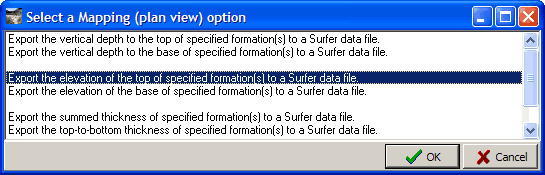
Choose a suitable option; exporting the elevation is appropriate.
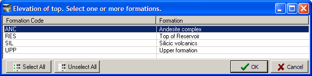
Choose the formation that you believe is correlated with permeability:
GeoData Manager creates a file.
Open the file as a contour in Surfer and compare it with other maps of permeable regions:
See here to map permeable regions from feedzones.
See here to map permeable regions from the simulation model rock types.
If those other maps indicate that a permiable region is linear in shape as in the map from feedzones here then you could make a cross section of the formations along the line, which will show you all the formations and their depths see how in this tutorial.